Celebrating 100 Million Measurements and Dublin Launch with Google Air View
Google’s Project Air View, launched in 2015 by Google and Aclima, has reached a new milestone of more than 100 million air pollution and greenhouse gas measurements collected globally since the research phase of our collaboration to measure air pollution began.
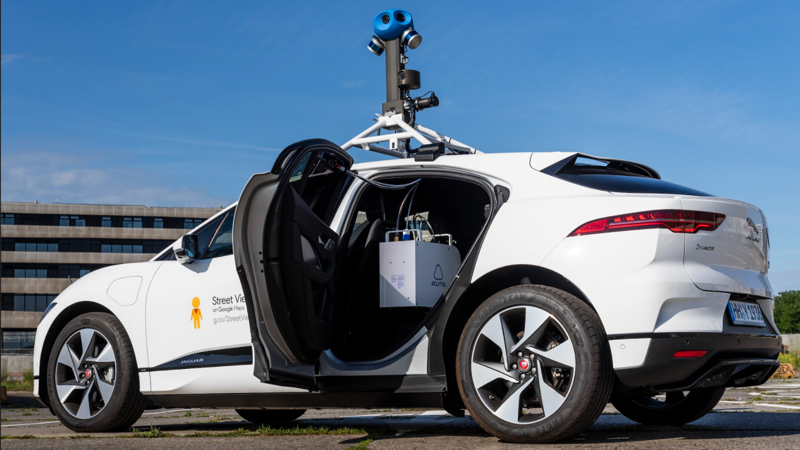
With EU Green Week kicking off on Monday, we’re also celebrating with Google the launch of Air View with Aclima in the City of Dublin. Aclima air pollution and greenhouse gas measurement and analysis technology integrated with Google’s first all-electric Street View car – a Jaguar I-PACE – will produce hyperlocal air quality insights for the Dublin City Council as part of its Smart Dublin program.
Aclima is Google Street View’s global partner for sensing air quality with Street View vehicles. Aclima provides the sensor instrumentation, data, and analytics infrastructure, and scientific expertise to support high-quality delivery and interpretation from the mobile platform.
VIDEO: Google Air View launches Aclima hyperlocal air pollution and greenhouse gas measurement in Dublin in partnership with Dublin City Council
Aclima’s mobile air monitoring platform measures and analyzes nitrogen dioxide (NO2), nitric oxide (NO), carbon dioxide (CO2), carbon monoxide (CO), fine particulate matter (PM2.5), and ozone (O3) along with geospatial and meteorological data within dozens of Street View vehicles as they traverse cities around the world.
.jpg?width=820&name=Google%20Street%20DCC%202021-1886%20(1).jpg)
PHOTO: An Aclima Mobile Node senses air pollution and greenhouse gases in Dublin, Ireland (May 2021)
Google makes this data available to researchers and city officials through Environmental Insights Explorer (EIE), a free tool that provides thousands of cities with actionable data and insights to reduce their emissions.
Building on more than three years of research collaboration with Aclima mobile laboratories, in 2018 Google announced their plans to expand air quality mapping with Aclima in Street View cars around the globe.
In 2020, Aclima and Google made a massive air pollution dataset freely available to the scientific community. Over the course of four years, the two companies had together generated and aggregated more than 42 million hyperlocal air quality measurements throughout California. This dataset has helped researchers to advance our understanding of hyperlocal air pollution and its impacts on human health, with peer-reviewed research publications including Environmental Science & Technology and Environmental Health Journal.
Recent studies have advanced scientific knowledge of the way air pollution varies over space and time, and how disproportionate potential exposures correlate with disproportionate health impacts:
- In June 2020, two studies compared mobile and stationary air quality monitoring and mapping in Atmospheric Measurement Techniques (Paul A. Solomon and other Aclima scientists along with the U.S. EPA, EPRI, Envair) and Environmental Science and Technology (Sarah E. Chambliss and other UT Austin scientists along with Aclima, UC Berkeley, LBNL, EDF, and UW), using Aclima and Google research data from Los Angeles, San Francisco, the northern San Joaquin Valley, and West Oakland, CA.
- In October 2020, a research paper led by Andrew R. Whitehill at the U.S. Environmental Protection Agency in Atmospheric Environment X generated statistical techniques for assessing mobile monitoring data to improve hyperlocal air quality mapping and exposure modeling using data collected in Denver with the Aclima platform installed on three Google Street View cars.
- In March 2021, Environmental Health Perspectives published a study using Google and Aclima hyperlocal research data entitled “Assessing the Distribution of Air Pollution Health Risks within Cities: A Neighborhood-Scale Analysis Leveraging High-Resolution Data Sets in the Bay Area, California,” led by Veronica A. Southerland who is an Environmental Protection Specialist in the U.S. EPA and a PhD candidate at the Milken Institute School of Public Health at George Washington University.
To learn more about the mobile air quality mapping research and global scaling partnership between Aclima and Google please go here.
As Aclima brings new air quality insights to more cities around the world, we will gain a deeper understanding of where air pollution and greenhouse gas emissions are generated and distributed in the air, who they affect on the ground, and how decision-makers can apply these insights to clean the air, reduce climate-changing emissions, and build healthier and more sustainable cities for all.
Share this
You May Also Like
These Related Stories

Bay Area Air Quality Management District and Aclima unveil results from groundbreaking hyperlocal air and greenhouse gas measurement mobile network

Aclima and Google Now Measuring Air Pollution and GHGs Block by Block in Hamburg

/2022_Aclima_Logo_Mist_500px_wR.png?width=501&height=193&name=2022_Aclima_Logo_Mist_500px_wR.png)
